
Wednesday system weaking
Less snow and ice

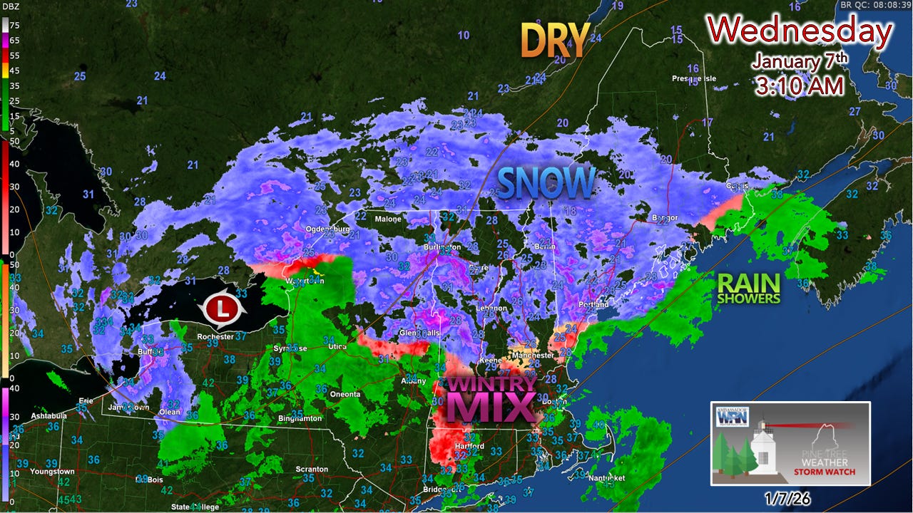
A look at the system to the west over Lake Ontario. Dry air to the north is gobbling up what little moisture there is in that area.
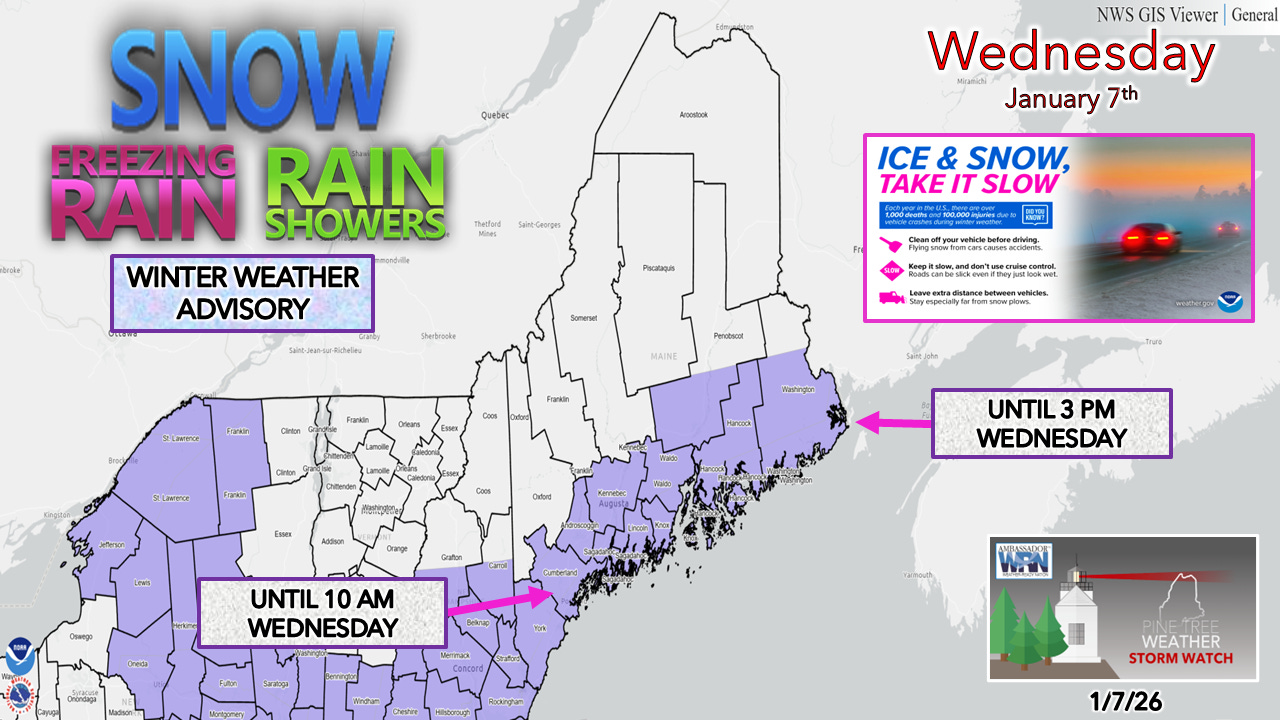
NWS Gray and Caribou have cancelled Winter Weather Advisories over the interior.
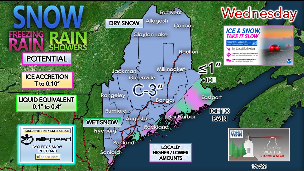
The forecast ice has been trimmed back and is now confined to a narrower area along the coast. Snowfall amounts have also been cut. Far northwestern areas of The County may get nothing out of this.
Cleanup on this one is optional, as Mother Nature will help with the warm-up on the way.

End timing of precipitation
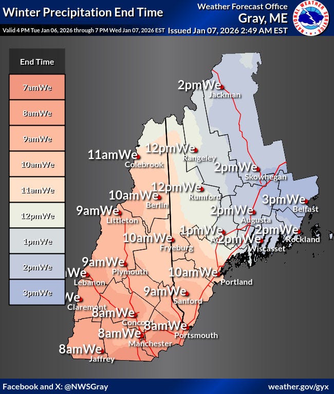
For much of the west and south, this is over by midday. Temperatures are expected to warm to the low to mid-30s, with the sun potentially making an appearance later in the day.
Important to note: the liquid will freeze tonight as temperatures fall back into the upper teens to mid-20s.
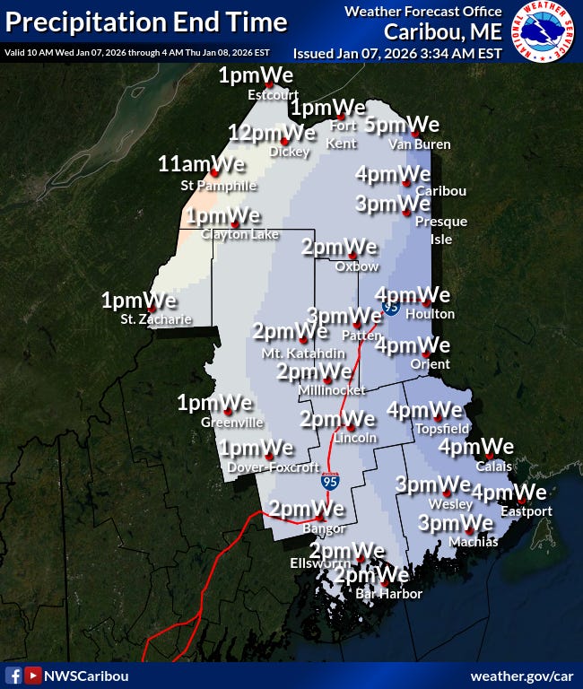
End times over the north and east have been pushed up as well.
High temperatures are expected to reach the mid-30s for Bangor / Downeast, flirt with 32° in Caribou, and be around 30° in the Allagash.
It will feel relatively mild overnight, with lows in the teens to mid-20s.
Stay tuned to pinetreeweather.substack.com and check the “Notes” feature

Scarborough just interior 295, 5:55 am .5-1"snow and very light sleet now at 24*. Thanks for a more accurate forecast!
1.5” still snowing lightly Farmington on the hill.