Increasing clouds for Tuesday
A potentially unsettled start to the weekend; drought thoughts

Synopsis
An area of low pressure dips into New Brunswick on Tuesday, dragging a very weak backdoor cold front through the state. The strong upper-level omega block to the west pushes high pressure into the region heading into Wednesday and holds it through Thursday. A backdoor cold front begins to enter the far north heading into Friday afternoon, then sinks south through Saturday, then may stall across Massachusetts by Sunday morning. High pressure enters from the northwest on Monday.
Potential impacts
Chance of thunderstorms for the far north on Friday afternoon, and statewide Saturday afternoon.
Tuesday
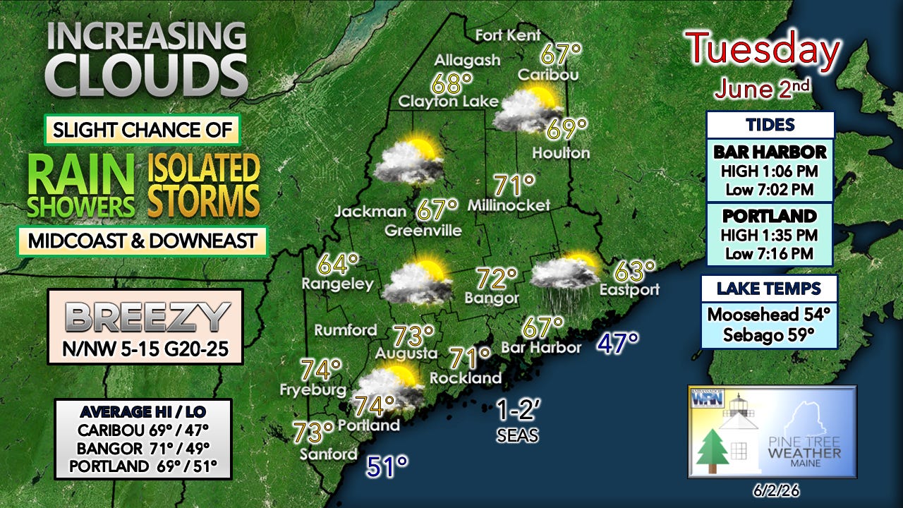
A backdoor cold front passes through the region as a weak area of low pressure drops in from the Gaspè Penninsula into central New Brunswick. This will increase cloud cover statewide through the day.
The northerly breeze picks up during the day and gets a bit gusty in the afternoon. The southwesterly flow ahead of the front is the key feature to watch after 2 PM along the MidCoast and DownEast areas as a coastal front develops and feeds a bit of moisture into the boundary, and that is where there is a risk of a pop-up shower, with a very low risk of a rumble of thunder possible through early evening. As the sun sets, the threat diminishes as the weak front fizzles out over the Gulf of Maine.
The sky clears out, and the wind diminishes overnight. A southwest flow develops as an upper-level ridge to the west advances into the region, keeping overnight low temperatures mainly in the 40s.
Wednesday
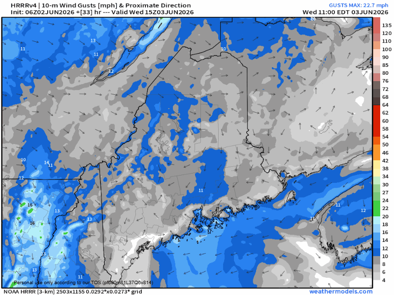
A weak area of high pressure slides through the Gulf of Maine during the day. As it does, a rather stiff seabreeze begins to develop in the afternoon and works its way well inland by evening.
Wednesday 11 AM to Thursday Midnight:
As the seabreeze cranks up, temperatures will fall thanks to the cool air coming in off the ocean. The areas protected from it stay the warmest for the longest.
The sky appears mainly sunny statewide, with a few late afternoon clouds forming over the interior as the southerly breeze works inland.
As the surface high tracks eastward, a southwesterly flow increases aloft, bringing warmer temperatures for Thursday.
Thoughts on the drought
There are two common questions I have been getting lately. One, did the rain in May help the drought situation? Yes, for short-term relief, for some areas. From an agricultural aspect, we’re in better condition. For those who depend on groundwater resources, the situation remains guarded.
While it was a wet May for most of the state, in some areas, it barely put a dent in the long-term deficit.
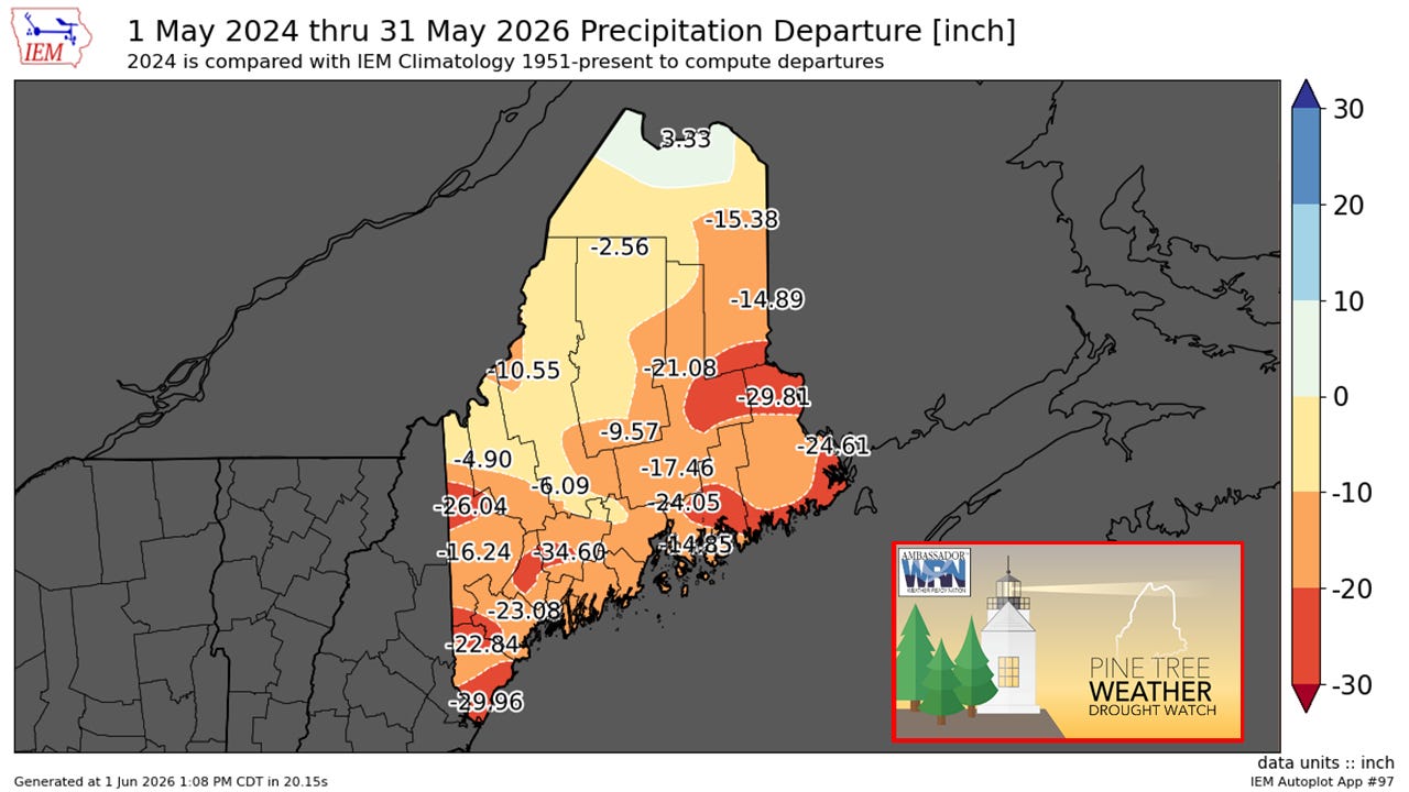
While the above chart is a tool based on climatology averages since 1951, I did some additional research and looked at hard numbers over the past two years:
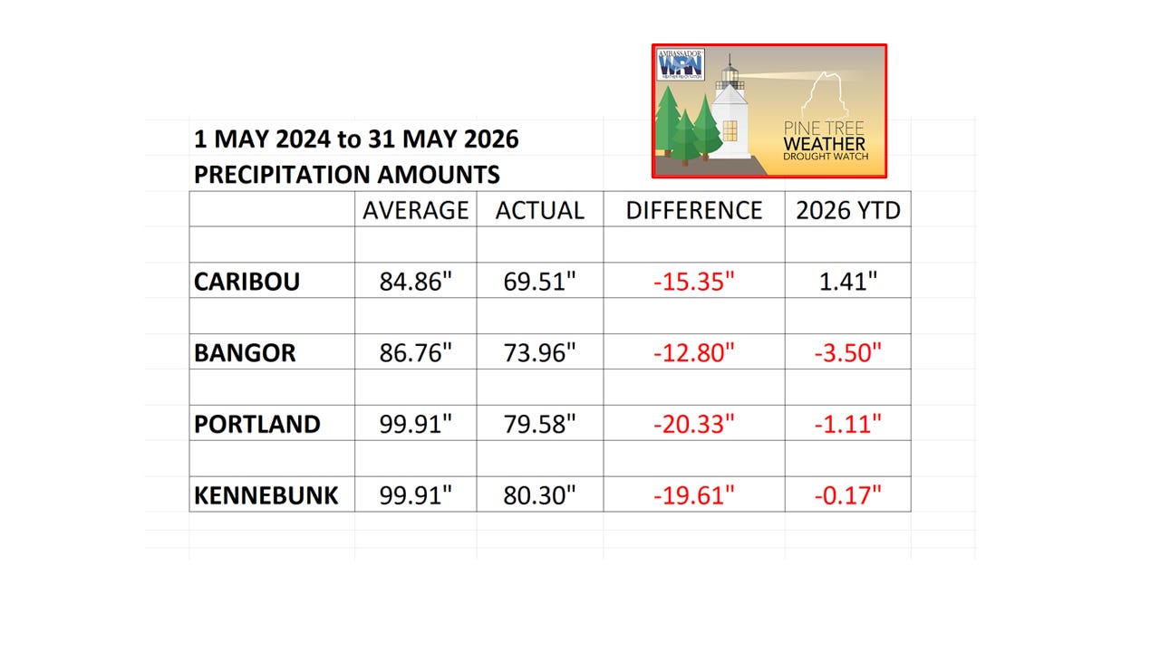
The rain received across the south and north (Bangor missed out) may give folks the false impression that the groundwater drought is over. What it did do was to get some areas caught up with their year-to-date averages and put a small dent in the long-term shortfall.
There have been improvements, but with double-digit deficits persisting as much of the state enters dry season, the recharge may be short-lived. Potluck shower-and-storm season has arrived. With the well-hyped “Super El Niño” taking shape, which may effectively limit tropical storm development, that does not bode well for widespread rain chances. The rise in humidity and the instability that comes with it will trigger locally heavy rainfall until the long-wave season returns in the fall.
The other question I have been asked about is whether the wet pattern will continue, and that answer is no.
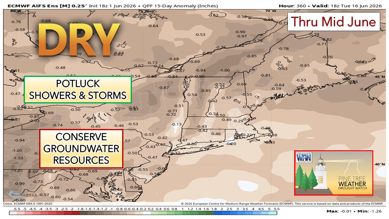
For those who depend on groundwater resources, the conservation should continue until further notice.
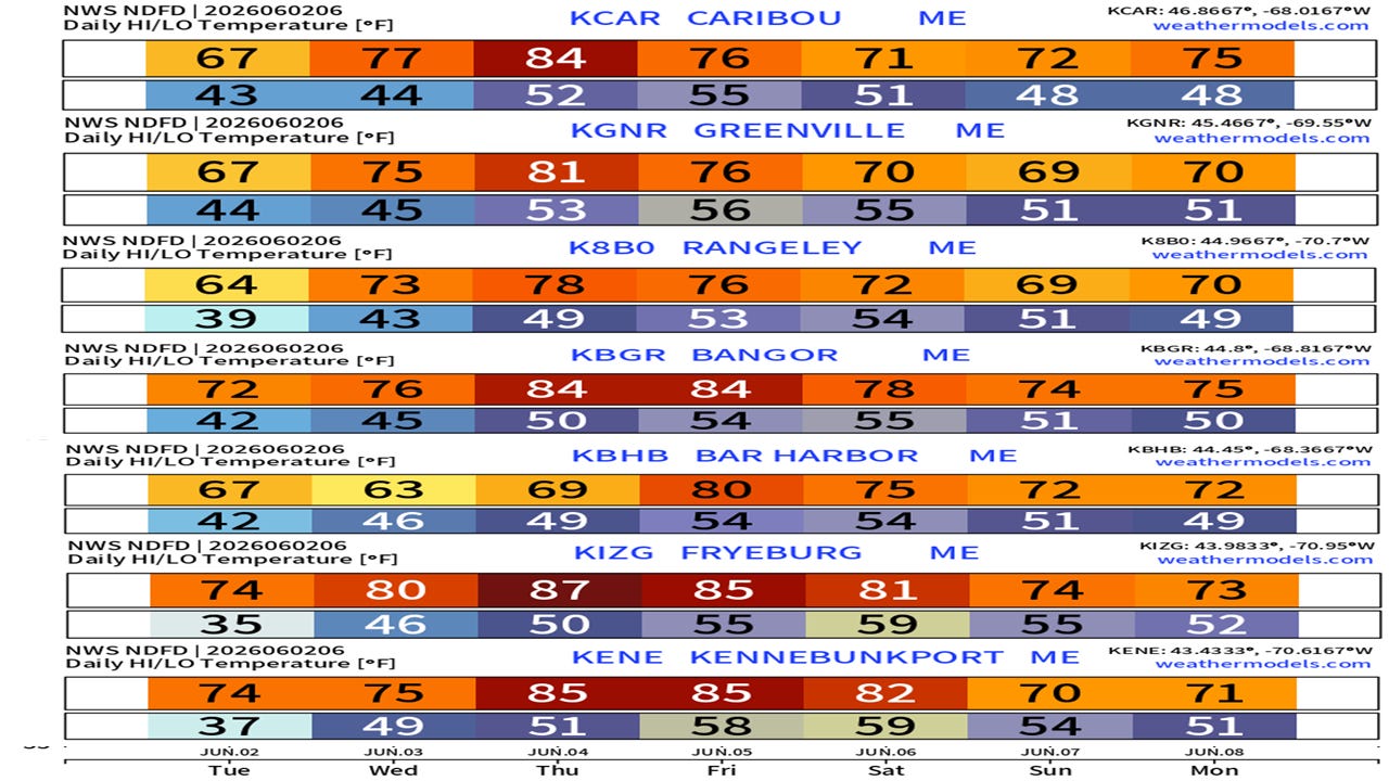
Temperatures and extended outlook
This warm stretch avoids humidity until Saturday, as dew points may creep up into the low to mid-60s over the coastal plain as the next backdoor cold front enters the region. The instability that creates brings the best chance for showers and storms, and perhaps some coastal fog development. Sunday appears dry to the north. Where the front stalls to the south dictates whether southern areas may get a shower, and if the sun can come out.

Link: How do I upgrade from being a free subscriber to a paid subscriber?